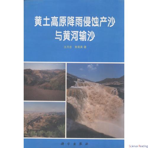
内容简介 本书对黄土高原水土流失区降雨侵蚀产沙与黄河输沙的时空分布特征、变化规律以及相互间的关系进行了系统研究。主要包括:降雨特征与降雨侵蚀力、中小流域降雨分布的不均匀性与点面关系、侵蚀产沙的区域分异与年际变化、不同空间尺度的雨沙关系、黄河泥沙的变化特征及趋势分析等。这是作者“八五”攻关课题研究的最新成果,可供有关研究黄土高原水土保持、环境、水文、泥沙、自然地理等方面的专业人员及高等院校有关专业师生参考。 BRIEF INTRODUCTION The temporal and spatial distribution of rainfall,erosion,and sediment yeild on Loess Plateau and the sediment transportation in the Yellow River Basin and their relationships systematically studied in this book.It mainly includes rainfall characteristics,rainfall erosivity,nonuniformity of rainfall distribution and relation between point and areal of rainfall in medium and small watershed,regional variation and annually change of erosion and sediment yeild,relationship between rainfall and sediment on different area scale,the sediment yeild change and its tendency in the Yellow River Basin. This book is suited for scientific workers,teachers and students who are engaged in those fields such as soil and water conservation,erosion environment,hydrology,sediment and physical geography,etc.
暂时还没有任何用户评论
全部咨询(共0条问答)
暂时还没有任何用户咨询内容
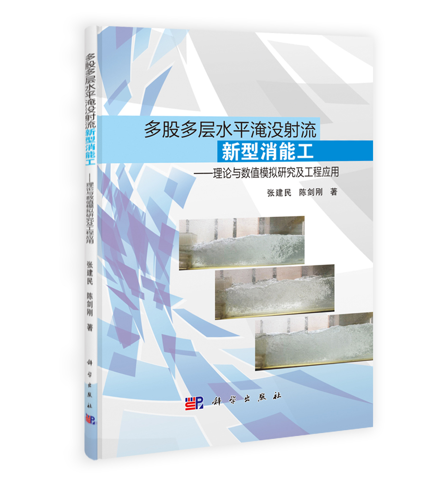
目录
Foreword Chapter 1 Rainfall on the Loess Plateau 1.1 Geographical conditions and climate features of rainfall 1.1.1 Landforms and rainfall of the Loess Plateau 1.1.2 Climate features of rainfall on the Loess Plateau 1.2 Spatial distribution features of rainfall 1.2.1 Spatial distribution of annual rainfall and days of rain 1.2.2 Spatial distribution of different grade of rainfall and days of rain 1.2.3 Spatial distribution of maximum rainfall in different duration 1.3 Temporal distribution features of rainfall 1.3.1 Monthly distribution of rainfall 1.3.2 Yearly distribution of rainfall 1.3.3 Time concentration of rainfall 1.4 Rain-storm on the Loess Plateau 1.4.1 Rain-storm criterion 1.4.2 Precipitation characteristics of different patterns of rain-storm 1.4.3 Catastrophic rain-storm,daily rain-storm in large area and extreme value of rain-storm 1.4.4 Rain-storm frequency and rain-storm center 1.4.5 Case study of typical catastrophic rain-strom 1.5 Brief summary References Chapter 2 Nonuniformity of rainfall and relationship between point rainfall and areal rainfall in medium and small watershed 2.1 Purpose and method 2.2 Nonuniformity of spatial distribution of rainfall 2.2.1 Nonuniformity of spatial distribution of individual rainfall amount 2.2.2 Nonuniformity of spatial distribution of individual rainfall intensity 2.2.3 Nonuniformity of spatial distribution of yearly rain amount 2.2.4 Nonuniformity of spatial distribution of yearly maximum rainfall intensity of different time period 2.2.5 Randomness of rain-storm center 2.3 Representativity of a point rain gauge for the whole watershed 2.3.1 Representativity of a central rain gauge for the whole watershed 2.3.2 Representativity of a rain gauge at outlet for the whole watershed 2.4 Features of spatial variation of rainfall 2.4.1 Analysis of station density used to predict individual rainfall sediment yeild 2.4.2 Analysis of station density used to predict yearly rainfall sediment yeild 2.4.3 Spatial correlation characteristics of rainfall amount 2.5 Point and areal rainfall relationship of different rainfall patterns 2.6 Brief summary References Chapter 3 Rainfall erosivity of the Loess Plateau 3.1 Definition of rainfall erosivity index 3.1.1 Main structure patterns of R index at home and abroad 3.1.2 Definition of R index on the Loess Plateau 3.2 Simple calculation method of R value 3.2.1 Classical calculation method of R value 3.2.2 Simple calculation of R value of individual rainfall 3.2.3 Simple calculation of R value of yearly rainfall 3.2.4 Simple calculation of average annual R value 3.3 Spatial and temporal distribution of R value 3.3.1 Time distribution variation of R value 3.3.2 Rainfall distribution features of R value 3.3.3 Spatial distribution of R value 3.4 Contour map of R value 3.5 Brief summary References Chapter 4 Relationship of rainfall,erosion and sediment yeild 4.1 Features of erosive rainfall 4.1.1 Criterion of erosive rainfall 4.1.2 Features of erosive rainfall 4.2 Relationship and process variation of rainfall,runoff-generating and sediment yeild in different catchment 4.2.1 Rainfall variation in slope runoff-generating process 4.2.2 Process variation of runoff-generating and sediment-generating 4.2.3 Relationship and process variation of rainoff-generating and sediment-generating in small watershed 4.2.4 Difference of process variation of runoff-generating and sedimentgenerating in different catchment 4.2.5 Relalionship between discharge and sediment concentration 4.3 Statistical analysis and prediction of relationship between rainfall and sediment 4.3.1 Statistical analysis and prediction of relationship between individual rainfall and sediment yeild 4.3.2 Statistical analysis and prediction of relationship between yearly rainfall and sediment yeild 4.4 Rainfall runoff-generating and sediment-generating features of extreme intense erosion 4.4.1 Features of runoff-generating and sediment-generating of rainfall in extreme intense erosion 4.4.2 Introduction of rainfall runoff-generating and sediment-generating of Chabagou and Jiuyuangou watershed 4.5 Brief summary References Chapter 5 Calculation and distribution of sediment yeild on the Loess Plateau 5.1 Statistical method of sediment yeild and the definition of sediment yeild intensity 5.1.1 Statistical analysis method of sediment yeild 5.1.2 Classification of sediment yeild intensity 5.2 Spatial concentration and regional difference of sediment yeild 5.2.1 Spatial concentration of sediment yeild 5.2.2 Regional difference of sediment yeild 5.2.3 Sediment yeild mapping 5.3 Time variation and concentration of sediment yeild 5.3.1 Yearly change of sediment yeild 5.3.2 Time concentration of sediment yeild 5.3.3 Year to year change of sediment yeild 5.4 Reason of reducing of sediment yeild since 1970's 5.4.1 A review of researching in the causes of reducing of sediment yeild 5.4.2 Evaluation of effects of water conservancy,soil and water conservation measures 5.4.3 On sediment yeild decrease analysis of the reason reducing sediment by using the variation of rainfall erosivity 5.5 Limit of sediment concentration and maximum soil erosion 5.5.1 Limit of sediment concentration 5.5.2 Maximum soil erosion 5.6 Brief summary References Chapter 6 Sediment variation characteristics and trend analysis over last 70 years in the Yellow River Basin 6.1 Spatial variation of sediment discharge 6.1.1 Sediment discharge variation along the Yellow River Basin 6.1.2 Regional variation of sediment discharge in the Yellow River Basin 6.2 Time variation of sediment discharge in the Yellow River Basin 6.2.1 Yearly variation features of sediment discharge in the Yellow River Basin 6.2.2 Yearly concentration of sediment discharge in the Yellow River Basin 6.2.3 Year to year variation of sediment discharge of the Yellow River Basin 6.3 Sediment yeild change and tendency over last 70 years in the Yellow River Basin 6.4 Analysis of soil and water loss in the Loess Plateau,sediment discharge of the Yellow River and man-control prospect in the future 6.4.1 Soil loss control prospect 6.4.2 Relationship between sediment yeild and sediment discharge 6.4.3 Soil and water loss amount on the Loess Plateau and sediment discharge in the Yellow River Basin in the future 6.5 Brief summary References


 京公网安备 11010102004214号